
Business Details
Expert Land Surveying and Site Engineering Services
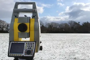
At J D Surveying, we deliver first-class surveying and engineering services across the South East of England and the UK. Our expertise spans topographical surveys, measured building surveys, and site engineering, tailored to meet diverse client needs from small domestic projects to large commercial developments. Utilising cutting-edge technology such as 3D laser scanning and drone surveys, we ensure millimetre-accurate results for planning, construction, and record-keeping. Our commitment to quality is reflected in our precise GPS surveys, volumetric calculations, and structural monitoring services. Clients trust us for our speed, professionalism, and ability to handle complex projects, as evidenced by testimonials praising our competitive pricing and detailed deliverables.We establish site control, gridlines, and datums to support seamless construction progress while maintaining rigorous accuracy standards. Our team produces elevation drawings, 3D models, and as-built surveys to aid future development and resolve boundary disputes. With a focus on client collaboration, we adapt to project requirements, ensuring timely delivery of survey drawings and actionable insights. Our services extend to aerial mapping, crack monitoring, and volumetric analysis, underpinned by Geomax GNSS technology for OSGB36-compliant results. J D Surveying combines technical excellence with a client-centric approach, making us a trusted partner for surveying needs.
Services
Topographical Surveys
Measured Building Surveys
Site Engineering
3D Laser Scanning
Drone Surveys
As-built Surveys
GPS Surveys
Volume Surveys
Monitoring
Highlights and features
- We utilise state-of-the-art 3D laser scanning and drone technology for accurate surveys.
- Our team delivers millimetre-accurate site control and gridline establishment.
- We handle projects from small domestic properties to large commercial developments.
- Clients praise our competitive pricing and prompt delivery of survey drawings.
- We provide OSGB36-compliant GPS surveys and volumetric analysis expertise.
What people say
Detailed drawings
Prompt service
Professional and friendly
Competitive price
Accurate service
Services
Topographical Surveys
We conduct detailed topographical surveys to map land features and elevations. These surveys support planning permissions, building developments, and boundary dispute resolution. Our tailored approach accommodates projects ranging from small gardens to large farmland areas, ensuring precise data collection for accurate decision-making.
3D Laser Scanning
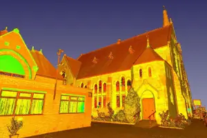
Using advanced laser scanners, we capture intricate details to create 3D point clouds and models. This technology enables production of elevation drawings, floorplans, and cross-sections with exceptional accuracy. The digital models assist architects and engineers in visualising structures for refurbishments or new developments.
Drone Surveys
Our UAV technology captures aerial imagery and topographical data for large sites. Applications include volumetric calculations, building inspections, and creating 3D models. Drone surveys provide cost-effective, rapid data collection over extensive areas while maintaining high accuracy standards.
Site Engineering
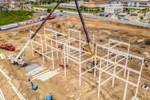
We establish precise site control, gridlines, and datums to guide construction work. Our millimetre-accurate measurements ensure correct positioning of structural elements, facilitating smooth project progression. This service supports builders in maintaining alignment with design specifications throughout development.
Measured Building Surveys
We produce detailed floorplans, elevations, and sections of existing buildings. These surveys aid in refurbishment projects, right-of-light assessments, and planning applications. Our documentation provides architects with accurate baseline data for renovation or extension projects.
Questions
What services does JD Surveying offer?
We provide topographical surveys, measured building surveys, 3D laser scanning, drone surveys, GPS mapping, and site engineering services for residential and commercial projects.
Which areas do you cover?
We operate across the South East of England and nationwide, handling projects of all sizes.
How do you ensure survey accuracy?
We use advanced technology like Geomax GNSS and 3D laser scanners to achieve millimetre-accurate results.
Are your prices competitive?
Yes, clients consistently highlight our cost-effective solutions without compromising on quality or precision.
How quickly are survey drawings delivered?
We prioritise timely delivery, with drawings typically provided promptly after on-site work completion.