
Business Details
Professional Surveying Services UK
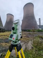
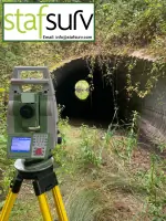
Established over five decades ago, South Staffs Surveys has built a reputation as a trusted provider of comprehensive surveying and engineering services across the United Kingdom. Our team of dedicated professionals combines extensive industry experience with advanced technological capabilities to deliver precise and reliable solutions tailored to client needs. Specialising in measured building surveys, utility mapping, bathymetric analysis, and site engineering, we support diverse sectors including construction, environmental management, and infrastructure development. Our commitment to accuracy is demonstrated through the use of cutting-edge equipment such as GPS systems, robotic total stations, and radio-controlled survey vessels. We maintain rigorous quality control standards while offering flexible service delivery models, including long-term site engineering support.With headquarters in Derbyshire, our operational reach extends nationwide, enabling us to respond promptly to projects of varying scale and complexity. Our expertise in earthworks planning and 3D modelling provides clients with critical data for informed decision-making in construction and land development projects. Through consistent delivery of technically robust solutions, we have established enduring relationships with major construction firms and local authorities. Our documentation packages include detailed reports, isopachyte contour plots, and shaded elevation models to ensure complete transparency in survey outcomes. Continuous investment in staff training and equipment upgrades ensures we remain at the forefront of surveying technology and methodology.

Services
Measured Building Surveying
Utility Surveying
Bathymetric Surveying
Site Engineering
Volume Calculations
Highlights and features
- We have over 50 years of experience in UK surveying and engineering
- Our team uses advanced GPS and robotic surveying technologies
- We provide comprehensive 3D modelling and volume calculation services
- Our documentation includes detailed isopachyte contour plots and shaded elevation models
- We offer nationwide service coverage with Derbyshire-based operations
Services
Measured Building Surveying
We produce detailed floor plans, elevations, and sections using advanced surveying technology. Our service supports architectural projects, property renovations, and building documentation requirements. Clients benefit from accurate dimensional data essential for construction planning and heritage preservation.
Utility Surveying
Our non-intrusive utility surveying identifies underground services including water, gas, and electrical infrastructure. This service prevents excavation damage and supports safe site development through precise location mapping using electromagnetic detection and ground-penetrating radar.
Bathymetric Surveying
We conduct underwater topographic surveys of rivers, canals, and lakes using radio-controlled vessels or manned boats. This service provides critical data for flood risk assessment, dredging operations, and aquatic habitat management through accurate bed level measurements.
Site Engineering
Our site engineering services establish precise construction reference points using GPS and robotic total stations. This supports infrastructure projects through accurate positioning of buildings, roads, and utilities to ensure compliance with design specifications.
Volume Calculations
We create 3D ground models to calculate cut and fill volumes for construction sites. This service optimises material usage, reduces transportation costs, and supports landfill management through detailed phasing plans and stockpile calculations.
Questions
What surveying services do you offer?
We provide measured building surveys, utility mapping, bathymetric analysis, site engineering, and volume calculations for construction and environmental projects.
How long have you been in business?
We have over 50 years of experience delivering surveying and engineering services across the UK.
What areas do you cover?
While based in Derbyshire, we operate nationwide and provide surveying services throughout the United Kingdom.
What technology do you use?
We utilise GPS systems, robotic total stations, radio-controlled survey vessels, and 3D modelling software for accurate data collection and analysis.
Can you handle large-scale projects?
Yes, we specialise in major earthworks planning, landfill cell design, and long-term phasing plans for infrastructure developments.
How do you ensure survey accuracy?
We maintain rigorous quality control through regular equipment calibration, staff training, and cross-verification of measurement data using multiple technologies.