
Business Details
12 Years
experience
Expert Land Surveyors in Wigan
Established in 2014, G E O Uk has built a reputation as a leading provider of professional land surveying services across the United Kingdom. Our team of expert surveyors, site engineers, and CAD technicians deliver precise and reliable data for commercial, residential, and infrastructure projects. With over 20,000 projects completed and a decade of industry experience, we prioritise accuracy, safety, and client satisfaction. Our comprehensive services include topographical surveys, underground utility mapping, concrete scanning, and 3D laser scanning, supported by cutting-edge technology and a commitment to innovation. We collaborate closely with clients to ensure tailored solutions that meet project-specific requirements, adhering to strict safety and regulatory standards.Our track record of successful partnerships with major construction firms underscores our dedication to excellence. Headquartered in Wigan, North West England, we combine local expertise with nationwide coverage to support diverse industries. Our accreditations and client testimonials reflect our unwavering focus on quality, reliability, and technical proficiency. By maintaining transparent communication and investing in continuous professional development, we ensure our team remains at the forefront of surveying advancements. This approach has solidified our position as a trusted partner for complex surveying challenges.
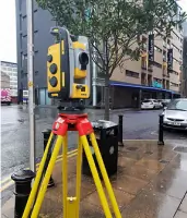
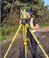
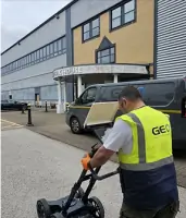
Services
Topographical Land Surveys
Ground Penetrating Radar (GPR) Surveys
Site Investigation
Concrete Scanning
3D Laser Scanning
Road Condition Surveys
Desktop Studies
Trialhole Verification
CCTV Surveys
Details
- Year established: 2014
Highlights and features
- We have over 10 years of experience in land surveying and site engineering.
- Our team uses cutting-edge technology for accurate and efficient surveying solutions.
- We offer a comprehensive range of services tailored to project-specific requirements.
- Our track record includes 20,000+ completed projects and 10,000+ visited locations.
- We prioritise safety, regulatory compliance, and client satisfaction in all operations.
What people say
Excellent standard
Professional
Great service
Highly recommend
Easy to work with
Services
Underground Utility Surveys
Underground Utility Surveys detect and map buried infrastructure such as pipes and cables using advanced detection equipment. This service ensures safe excavation, prevents damage to existing utilities, and supports compliance with safety regulations. It is essential for construction planning, infrastructure maintenance, and environmental protection projects requiring precise subsurface data.
Site Investigation
Site Investigation assesses subsurface conditions through surveys and testing to inform construction feasibility. This service identifies geological risks, contamination, and structural challenges, enabling accurate foundation design and regulatory compliance. It reduces project costs and delays by addressing potential issues before development begins.
Concrete Scanning
Concrete Scanning uses Ground Penetrating Radar to locate embedded objects like rebar and conduits within concrete structures. This non-invasive method preserves structural integrity, prevents accidental damage during renovations, and ensures worker safety. It supports efficient planning for drilling, cutting, and maintenance operations.
3D Laser Scanning
3D Laser Scanning creates detailed digital replicas of physical environments using laser technology. This service provides precise measurements for construction, engineering, and heritage projects. It enhances accuracy, reduces rework, and offers future-proof digital records for ongoing project management.
Topographical Land Surveys
Topographical Land Surveys capture detailed terrain features and surface features using advanced surveying equipment. This service supports urban planning, infrastructure development, and environmental management by providing accurate elevation data and spatial analysis for informed decision-making.
People
James Sherman
Managing Director
James Sherman leads G E O Uk with strategic vision, driving growth and maintaining technical excellence across all surveying operations.
Joshua Stubbs
CAD Technician
Joshua Stubbs specialises in creating precise technical drawings and digital models to support surveying projects with accuracy and efficiency.
Andrew Lang
Associate Director
Andrew Lang focuses on strategic development and operational efficiency, ensuring G E O Uk's services meet evolving industry standards.
Elaine Sherman
Accounts Manager
Elaine Sherman oversees financial operations, ensuring transparency and compliance in all accounting practices across the organisation.
Matthew Barlow
CAD Manager
Matthew Barlow leads the CAD department, integrating innovative surveying technologies to enhance project delivery and client outcomes.
Questions
What services does GEO UK offer?
GEO UK provides topographical surveys, underground utility mapping, concrete scanning, 3D laser scanning, and site investigation services across the UK.
How long has GEO UK been in business?
GEO UK has been operating since 2014, completing over 20,000 projects nationwide.
Do you operate outside the UK?
While based in Wigan, we primarily serve clients across the United Kingdom.
What technology do you use for surveys?
We utilise Ground Penetrating Radar, 3D laser scanning, and advanced CAD software for accurate data collection and analysis.
How quickly do you respond to inquiries?
Our team aims to respond to all client inquiries within two working days.
Are your surveyors certified professionals?
Yes, our team includes expert surveyors, site engineers, and CAD technicians with extensive industry experience.